Sunday 22 April 2012

At The Sign of the Wild Boar


With the weather being so inclement currently I thought I'd nip out for a quick jaunt today.  I'm also planning a multi-day hike, so I'm investigating new paths in the peaks that I can string together into a 30-40 mile circular walk, with somewhere to bivvie half way round.

I also wanted to try a new stripped-down setup for my phone - anything I didn't need was removed, synching was switched off, the processor was throttled 50% and I ran in 2G only mode.  I use the phone for GPS and that hammers the battery.  For my multi-day I need to eke as much time as I can out of the battery, so that means as little as possible trying to phone home, or waking up to check on things.  

Not sure how much I gained - next is an experiment to see if an external Bluetooth GPS setup uses less power than internal GPS alone.  I'm not convinced, but I've read conflicting things about this.


Today I decided to pick up one of the paths that starts at the Wild Boar Inn in Wincle.  I took a route that would give me a 3 mile walk round the base of Hammerton Knowl.  Ive done bit of this route before, but it tends to be very wet, so I've always given up.

Not today though, because I was on a mission.  NNE of the Knowl I'd seen the magic word WATERFALL....


The other side of the stile.
I took the path on the Eastern side of the Inn and trekked up a fairly sodden and sheepy field to the first of the more disreputable stiles on this path.  The stile was 6 foot tall, and as you can see in the pic it leads you into a swamp.  The water is actually running, and I can attest that the mud is about eight inches deep.  If you stumbled and fell you would NEVER BE SEEN AGAIN.


 The path was fairly straightforward, and led down to Hammerton Knowl Farm, where I found the most confusing sign post in the whole of the Peak District.  At some point a hilariously drunken workman nailed three random arrows onto each side of the post and called it a day...
 Luckily, after wandering about for a bit the nice man who lives at the farm saw me standing in his garden juggling maps and GPS's and came out to see what was going on.  He put me on the right path - an eighteen-inch gap between two buildings.  I'd imagine the 90% of the murders in the Peak District happen on this path....most of the people who survive the path come a cropper at the entirely disreputable stile at the end of it.
 Thats about a 3 foot drop, and it finishes in a mixture of mud and the bones of the fallen...


From here the path was fairly easy to discern, and past The Hazels I picked up a metaled road that leads over Cessbank Common.


Picturesque...

I think this is Piggford Moor, Mount Pleasant and Shuttingslow

Memorial to a dog...


It was around this point I should have found the waterfall leading into Highmoor Brook, but I couldn't see it from the path and didn't want to  disturb the sheep...
The radio tower on Sutton Common


The next stage - I've just come from the gateway in the background and I'm going to the gateway in the foreground.


How fickle was the weather today?

 Hmmm....cows.  Not monstrously fond of cows.  They always seem a bit unpredictable, and are quite happy to trample you.  Horses are a much better bet.
Didn't find my waterfall, but I did find this delightful little fountainhead just a few hundred yards up the road from the Wild Boar.

Sunday 8 April 2012

The Hills of West Cheshire

Out towards the West of Cheshire lies a footpath - the Sandstone Trail.  The trail runs from Frodsham in the North down to Whitchurch in the South for a distance of 32 miles.

The Surly Gent and myself have been pondering the possibility of walking the Sandstone Trail for a couple of years now, and today we decided to make a start with one of the circular walks detailed in Circular Walks along the Sandstone Trail - not, I might add, a book I would rely on without an OS map as backup.


As we were slightly time limited we decided to pick a path from Raw Head to Larkton Hill - an advertised distance of about 5 1/2 miles.

We started off from The Sandstone (previously The Coppermine) at Brown Knowl, where we left the car, and headed across the A534 towards Park Wood.


The view up to Park Wood
The day was overcast, but not overly cold.  I was using my new Osprey Talon 8 lumbar pack, which is a neat piece of kit with some really nice design features - very impressive, comfortable and with lots of room for storage.  The only downside is that, as a fairly broad lad I find that the pack itself could be wider.  The straps are long enough, but I have to reach further round than I would like to get at the water bottles and side pockets - but thats a minor quibble, and for 95% of the population the fit would be fine.

View from Park Wood.

The gorse was out and looking lovely


As part of our adventuring TheSurlyGent and myself are issuing each other with challenges - mine for today was to make pine needle tea.  Park Wood supplied ample pines and larches, but discretion was the better part of valour and it was decided that it would be more sensible to find out exactly WHICH pines were safe to use for tea before devouring the first tree that came to hand.


Harthill Church
 The path took us into the village of Harthill, where we crossed the main road and into Garden Lane...
White Bells...?

Hale Superbole


...which eventually lead us up the side of Hale Superbole Mountain Boarding, and into some open beech woodland.


It was not long after this that things must have gone awry.  We were trying to pick up the path to Raw Head, the highest point on the mid-Cheshire range.  Somehow we missed the path and ended up in woodland, much of which was given over to pheasant production...but it was worth it.

Sandstone crags


A great prow of sandstone reared out of the woodland, and as we followed the path around it something amazing hove into view.....A CAVE!


TheSurlyGent models the cave we found on the way to Raw Head


Having thoroughly investigated the cave (it was about 8ft off the forest floor, 10ft deep and 20ft wide, so it was fairly easy to investigate) we re-examined our route and struck off for Raw Head.

The view from Raw Head

Making coffee on Raw Head


The Gent prepares to do a headstand for his own blog.


After a cup of coffee, some gymnastic hijinks and a bit of a rest we left Raw Head and continued what should have been a well defined and straighforward path back towards The Sandstone.

Spring Woodland

The Gent in thoughtful mood

Across the Cheshire countryside

More outcrops - it IS the Sandstone Trail after all

Kitty's Stone on Bickerton Hill


The path took us up Bickerton Hill, past Kitty's Stone and Maiden Castle.  Again, at this point something went wrong.

The route
The strange little dead-end on the bottom right hand corner of the route shows where we went wrong, and had to retrace our steps.

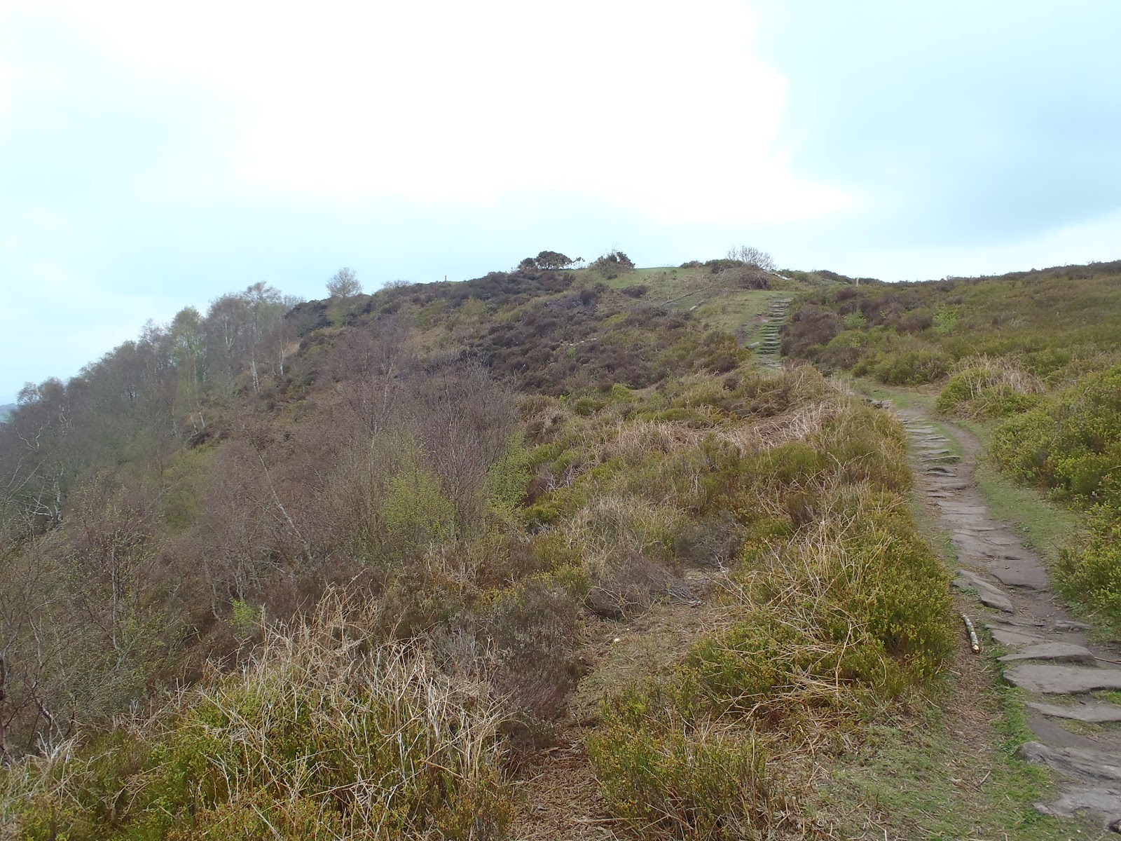
View back towards Maiden Castle

The correct path...


Eventually we found our way back to the road, and it was only a matter of time till we got back to The Sandstone pub.

The road route took us back Broxton Old Hall - it would have been nice if the guide had told us to expect this - we'd have known we were on the right track.  Walking on the road can always be a bit of a drag, but it was the final leg of the journey.

Spring is well under way, and sights like this makes it all worthwhile.


And thank goodness The Sandstone was still serving - a big, juicy burger and hand made chips really did make it all worthwhile - even more than the tree blossom


 What should have been a 5 1/2 mile journey actually was almost 9 miles!  We will take a map next time :)


For more information about the Sandstone Way have a look at this very nice PDF guide

Sunday 1 April 2012

The Moon of Gomrath!


Any Alan Garner fan will have an inkling where I went today....Errwood Hall, the site of a major part of Garners sequal to The Weirdstone on Brisingamen.

Anyway, enough of that.  Errwood Hall is a popular location, which, surprisingly, is right next to Errwood Reservoir.  It has a carkpark a short walk from the house, but I took a slightly longer route.

The road looking back towards The Cat And Fiddle

It was a lovely day...


The track from Cat and Fiddle to Errwood Hall

 Parking up by the Cat and Fiddle I started up the stony track to leads up towards the Shining Tor path.  Instead of turning to the left towards Shining Tor today I carried on, following the long, downward path that leads directly to Errwood.

       
The path drops sharply towards Errwood.


 Before I began the descent to Errwood Hall I decided that, with the stony paths out of the way it was time to give my Vibram FiveFingers some air.  I've used them in the gym for about a month, but this was the first time I'd used them on proper terrain.
First view of Errwood Reservoir


The Vibrams were great - they're very flexy with thin soles and I find they encourage me to go up on my toes.  Its a struggle not to run in them to be honest, and I'll be wearing them a lot more in future.

The path to Errwood is well trodden, and after a while turns into a wide, track covered in close-cropped turf.  Time to ditch the Vibrams and go fully barefoot!  Vibrams were re-applied about half a mile later when lack of traction left ThePeaksman sitting on his ass in the middle of the track - that never happens to Ray Mears....


At the bottom of the path the route branches, straight on heads towards the reservoir, left heads towards Errwood Hall.

Errwood Hall in its former glory
And how it looks today  - the arches were on the left hand side of the house (from outside) - we are looking towards the front door here.


The old front door

Family crest inside front door

The side windows from inside the house

I assume this might have been a door

The arches from outside

After photographing the hall I did some exploring, and stumbled across something I'd never seen before - and never even suspected...

The little black cross in the yellow diamond maks the spot of a tiny cemetery, holding about 8-10 graves of the family that ones lived in Errwood Hall.

I must admit, its a lovely spot, and I can't think of a more peaceful place to spend eternity.


After a spot of lunch I went back to the hall for a bit more of a poke around, and found an old trough set into the cliff behind the house.  While I was examining it I heard a loud buzzing.  Slightly aprehensive I carefully looked around expecting to see a bee hive or swarm.  Then I looked up...

 Some sort of tree (not sure what type), plastered in catkins.  And the catkins were plastered with bees!

Huge bumble bees and honey bees were everywhere - obviously enjoying the spring warmth.  I like bees, and they tend to be friendly so no problems there.
Catkins or flowers? Either way the bees loved them!


Thought this chap was a honeybee, but now I'm not so sure - he might be some flavour of wasp.


 And that was it....just the trek back to the car.  It was Vibrams all the way, and it was great.  A lovely in smashing countryside. 

Heres a few more shots around the hall, and a final view of the reservoir looking like the Mediterranean.

If you want to know more about Errwood Hall have a look here: The Grimshaws of Errwood Hall